KEY POINTS
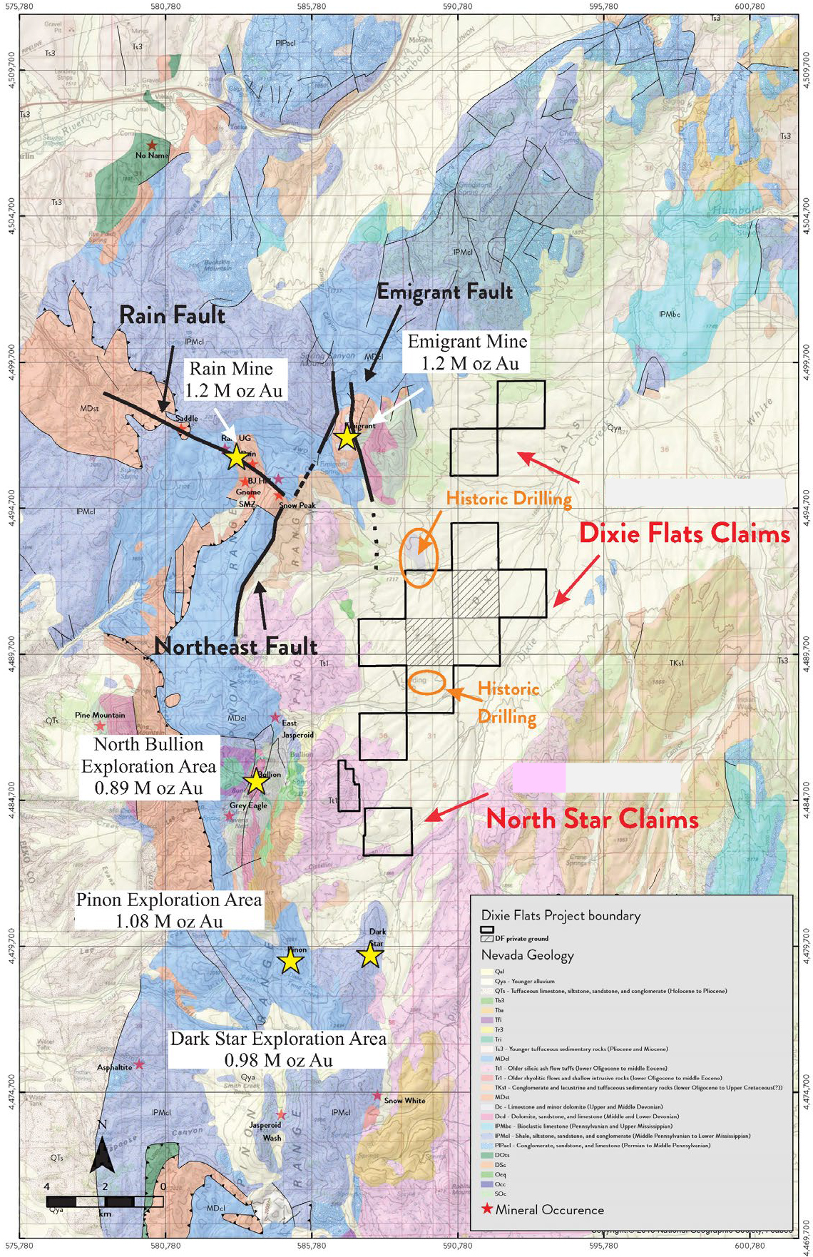
- On Trend location with strong exploration potential along projected strike of the ore-controlling Rain and Emigrant/Dark Star faults
- The stratigraphic Ddg/Dw host horizon at Rain, Emigrant, and Pinion is present at Dixie and hosts mineralization in some historic drill holes
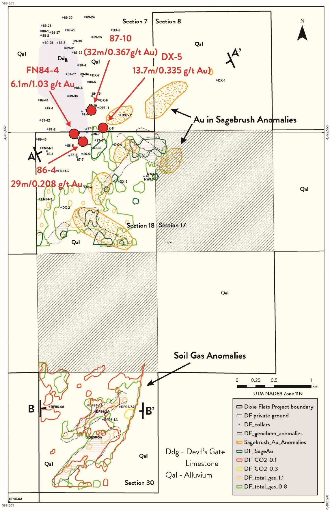
- Under-explored with 90% of the project undrilled due to alluvial cover with only 9 of 27 holes testing the target horizon, returning intercepts up to 0.208g/t Au over 29m and a high gold value in drill samples of 1.37 g/t Au
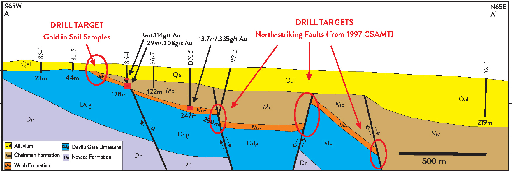
- Recent CSAMT lines identified strong exploration targets along N-striking faults that are well documented ore controls on the southern Carlin Trend
GEOLOGY
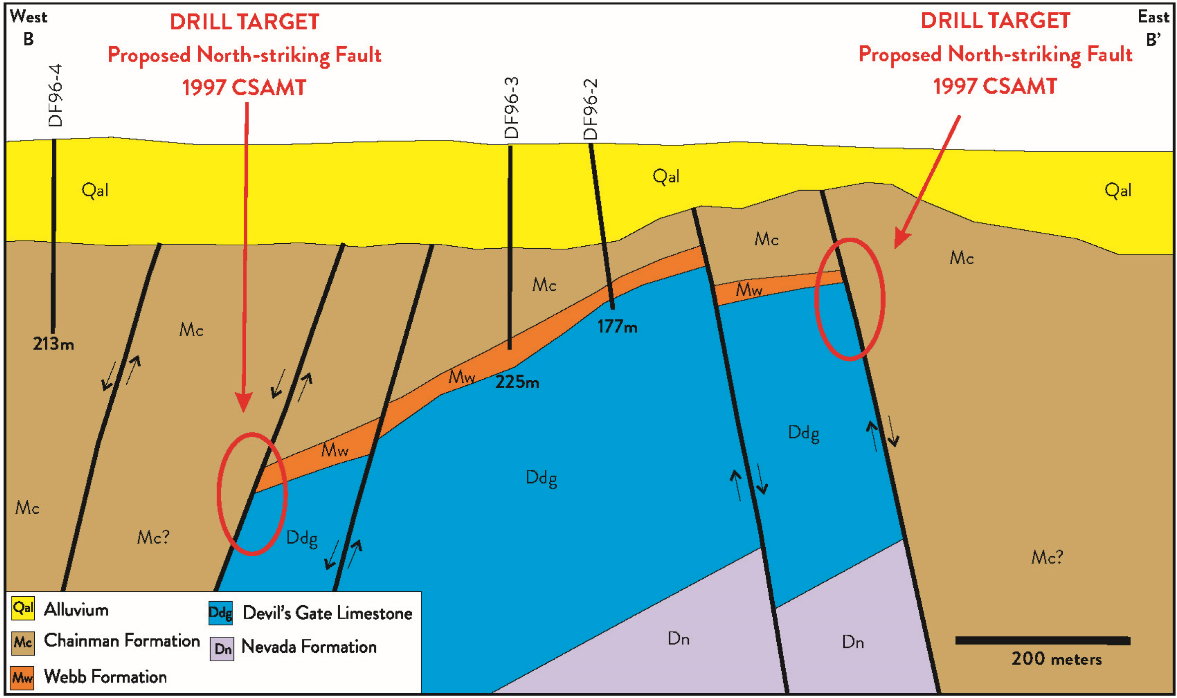
- HOST ROCKS – Altered and brecciated sections along the contact between the Mississippian Webb Formation and underlying Devonian Devil’s Gate Limestone at intersections with high-angle faults. The overlying Chainman Formation is also known to host disseminated gold deposits in the area
- STRUCTURE– NS, WNW, and NE striking faults, and anticlinal folds are known to control mineralization at surrounding deposits, and several of these project through Dixie as indicated by CSAMT data
- ALTERATION – Webb Formation is silicified, oxidized, brecciated, and contains barite and pyrite. The Devil’s Gate Limestone is locally silicified
- GEOCHEMISTRY – Gold-bearing mineralized zones commonly display elevated concentrations of As, Sb, and Ba, as well as weakly anomalous Ag
EXPLORATION TARGETS
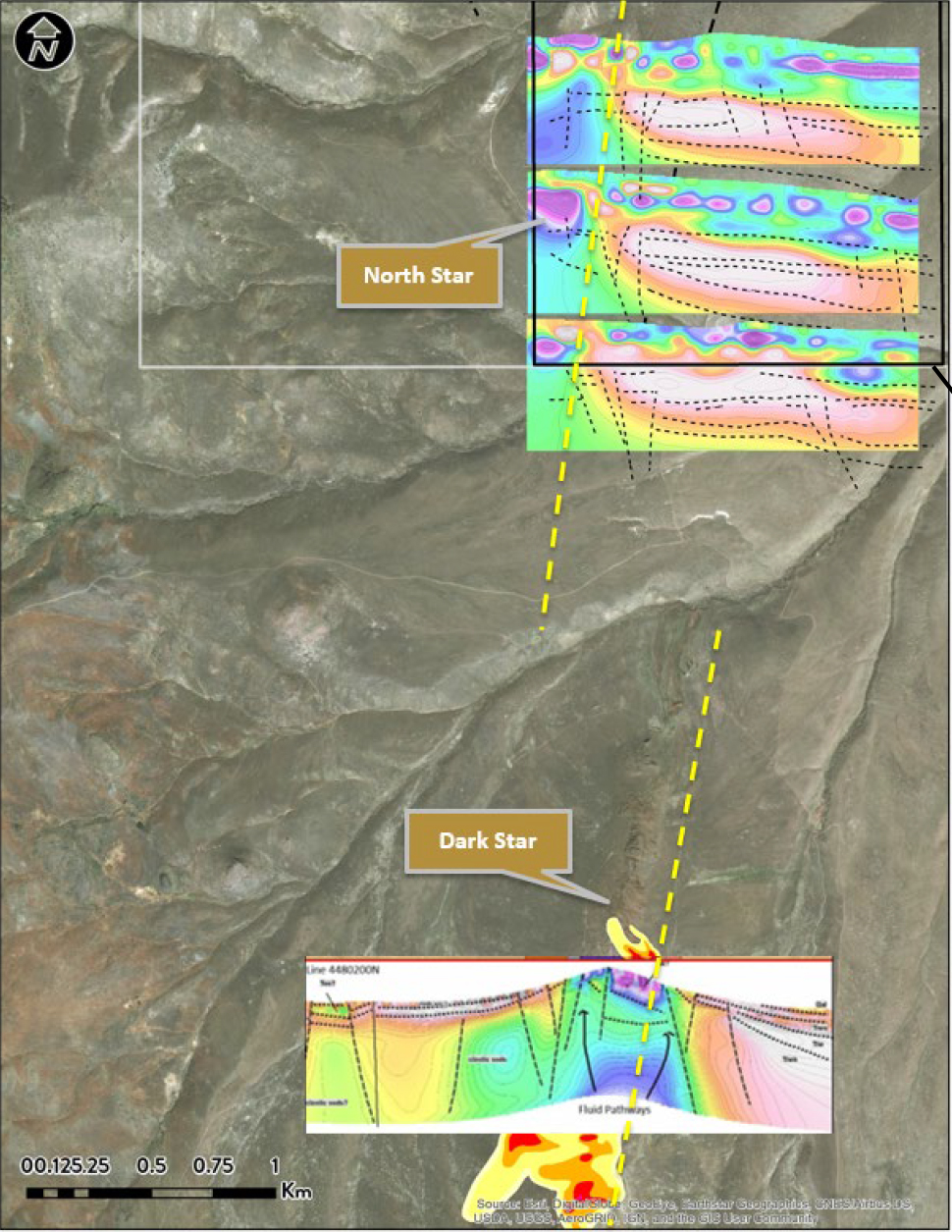
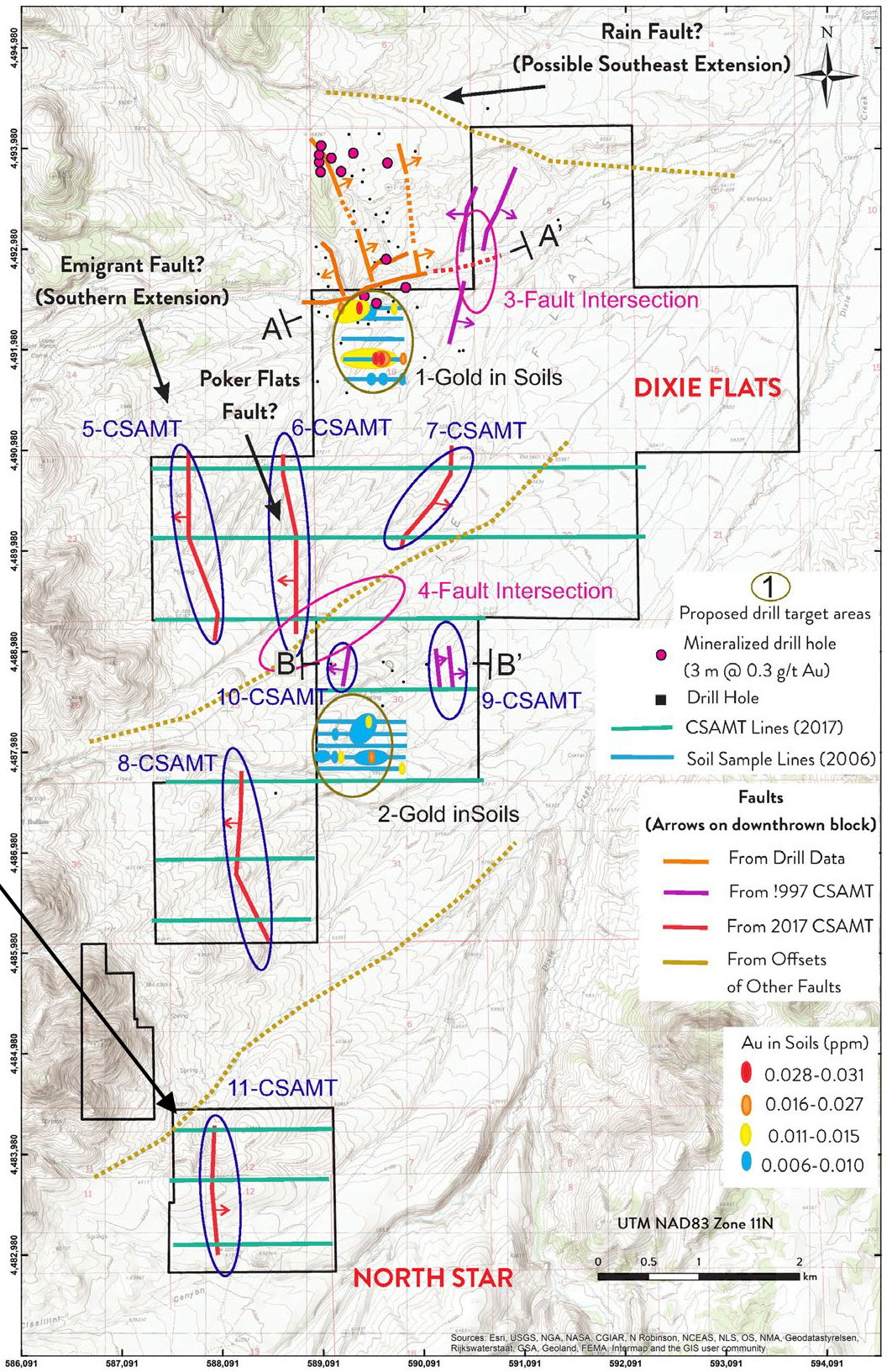
- North-Striking Emigrant to Dark Star Fault – Targets defined by CSAMT where they intersect the Webb/Devil’s Gate contact at depth
- Fault Intersections – Intersections of multiple faults of various orientations modeled from prior drilling and geophysics with areas of increased collapse breccia development which enhanced the volume of mineralizing fluid flow
- Soil Anomalies – Limited soil sample grids identified two general areas with anomalous gold in soils that remain untested by drilling.
- Rain Fault Extension – A buried fault that is interpreted to be the southeastern continuation of the Rain Fault strikes to the east-southeast across the northern portion of the claim block
DATA
- 314 Dixie, and 56 North Star claims on BLM – 31 km 2 on BLM with 2 internal private sections not part of this property package.
- 69, mostly shallow (100-200m, with 300m max) RC holes in the immediate vicinity, of which 27 holes are on the current claim block.
- 2017 and 1997 CSAMT surveys on the west side of the claim block.
- 1997 Soil gas and Metals in Sagebrush surveys.
- Site-specific geologic map of project area, including surrounding outcrops.
- 300 soil samples in two distinct grids.
- A 43-101 Technical Report for the Dixie Flats Project written in 2011.
Location
Southern Carlin Trend, Elko County, Nevada

